
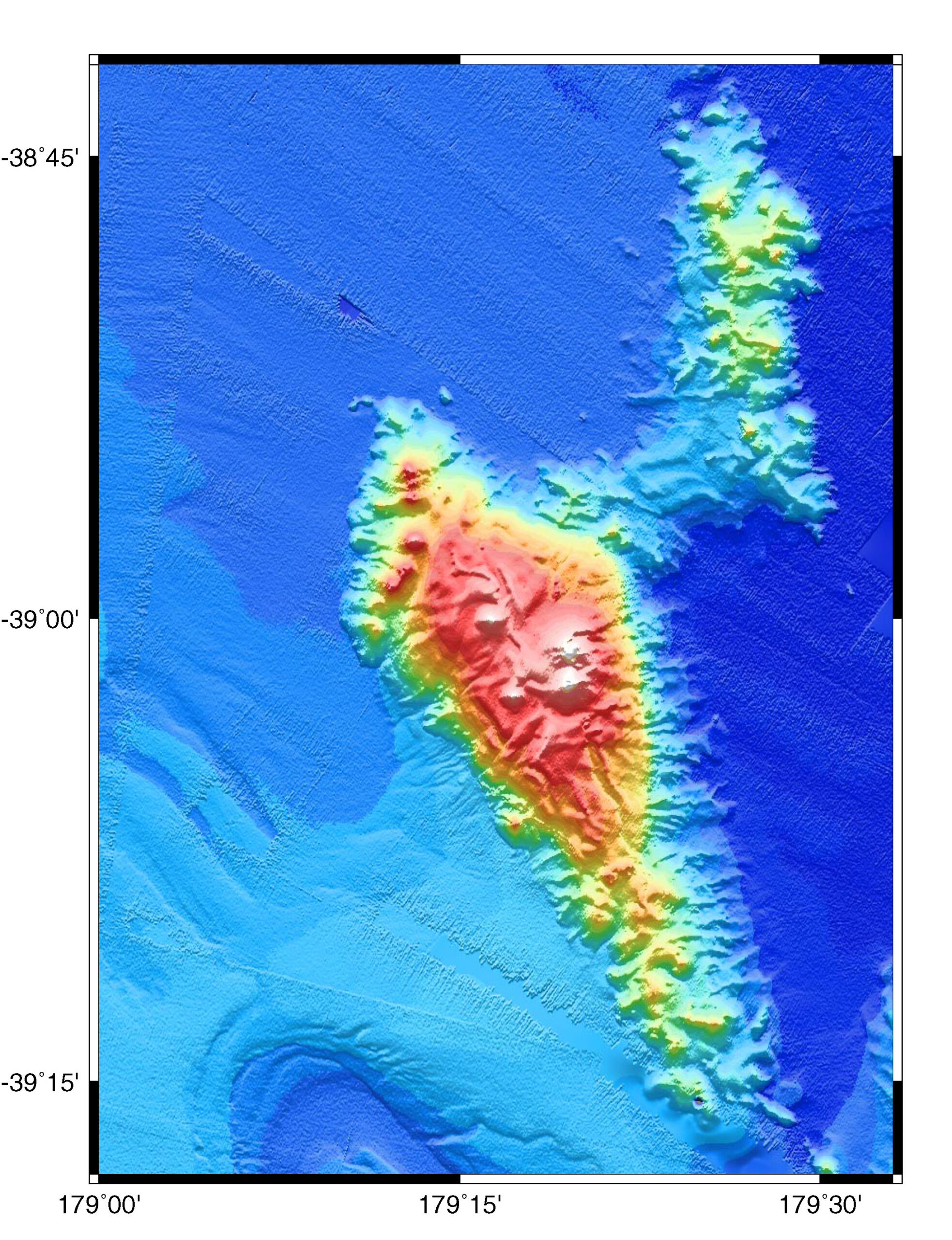
Subduction zones — places where one tectonic plate dives beneath another — are where the world’s largest and most damaging earthquakes occur. A new study has found that when underwater mountains — also known as seamounts — are pulled into subduction zones, not only do they set the stage for these powerful quakes, but also create conditions that end up dampening them.
The findings mean that scientists should more carefully monitor particular areas around a subducting seamount, researchers said. The practice could help scientists better understand and predict where future earthquakes are most likely to occur.
“The Earth ahead of the subducting seamount becomes brittle, favoring powerful earthquakes while the material behind it remains soft and weak, allowing stress to be released more gently,” said co-author Demian Saffer, director of the University of Texas Institute for Geophysics (UTIG), a research unit of The University of Texas at Austin Jackson School of Geosciences.
The study was published on March 2 in Nature Geoscience and was led by Tian Sun, who is currently a research scientist at the Geological Survey of Canada. Other co-authors include Susan Ellis, a scientist at the New Zealand research institute GNS Science. Saffer supervised the project and was Sun’s postdoctoral advisor at Penn State when they began the study.
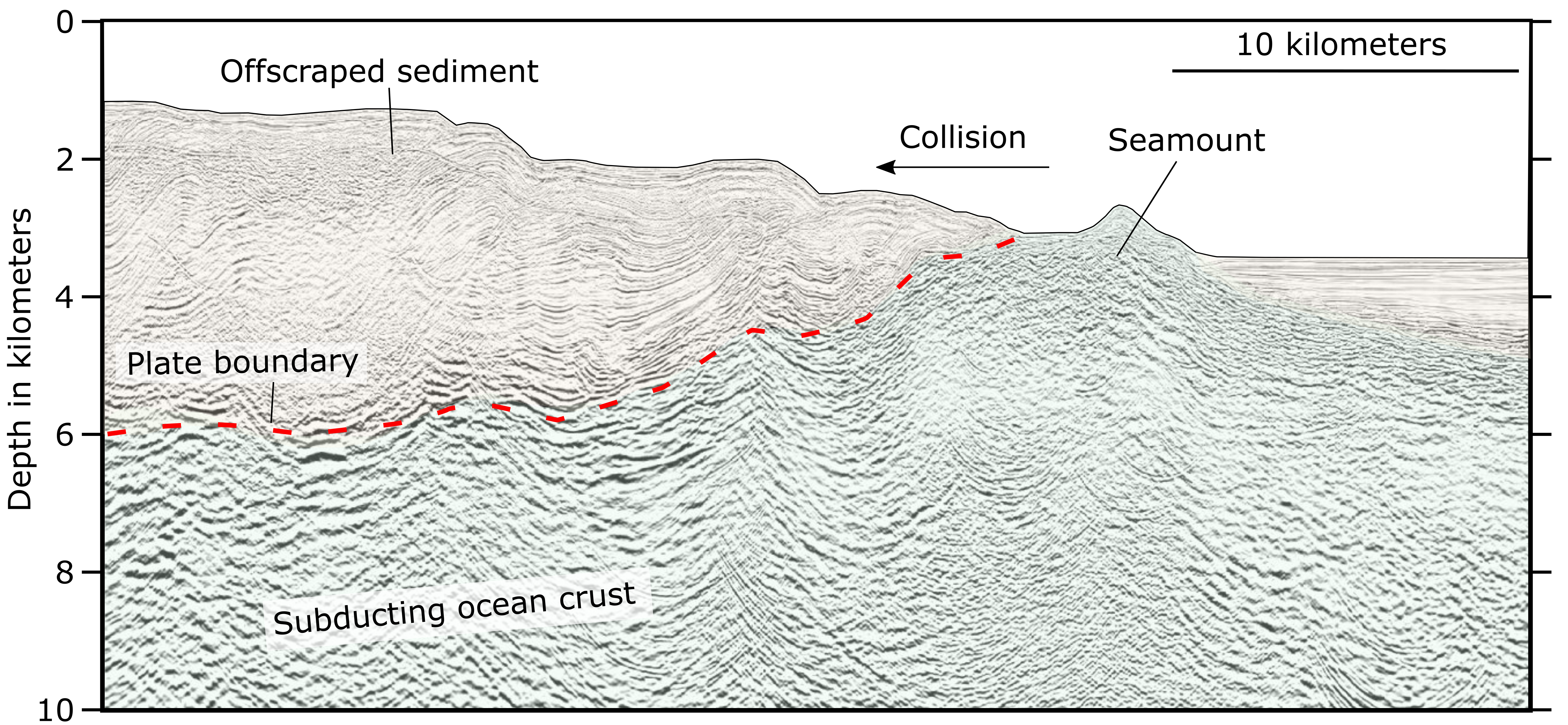
The researchers used a computer model to simulate what happens when seamounts enter ocean trenches created by subduction zones. According to the model, when a seamount sinks into a trench, the ground ahead of it becomes brittle, as its slow advance squeezes out water and compacts the Earth. But in its wake, the seamount leaves a trail of softer wet sediment. The hard, brittle rock can be a source for powerful earthquakes, as forces generated by the subducting plate build up in it – but the weakened, wet material behind the seamount creates an opposite, dampening effect on these quakes and tremors.
Although seamounts are found all over the ocean floor, the extraordinary depths at which subduction occurs means that studying or imaging a subducting seamount is extremely difficult. This is why until now, scientists were not sure whether seamounts could affect the style and magnitude of subduction zone earthquakes.

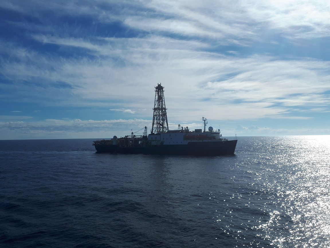
The current research tackled the problem by creating a realistic computer simulation of a subducting seamount and measuring the effects on the surrounding rock and sediment, including the complex interactions between stresses in the Earth and fluid pressure in the surrounding material. Getting realistic data for the model involved conducting experiments on rock samples collected from subduction zones by scientific ocean drilling offshore Japan.
The scientists said the model’s results took them completely by surprise. They had expected water pressure and stress to break up material at the head of the seamount and thus weaken the rocks, not strengthen them.
“The seamount creates a feedback loop in the way fluids get squeezed out and the mechanical response of the rock to changes fluid pressure,” said Ellis, who co-developed the numerical code at the heart of the study.
The scientists are satisfied their model is robust because the earthquake behavior it predicts consistently matches the behavior of real earthquakes.
While the weakened rock left in the wake of seamounts may dampen large earthquakes, the researchers believe that it could be an important factor in a type of earthquake known as a slow slip event. These slow-motion quakes are unique because they can take days, weeks and even months to unfold.
Laura Wallace, a research scientist at UTIG and GNS Science, who was the first to document New Zealand slow slip events, said that the research was a demonstration of how geological structures in the Earth’s crust, such as seamounts, could influence a whole spectrum of seismic activity.
“The predictions from the model agree very nicely with what we are seeing in New Zealand in terms of where small earthquakes and tremors are happening relative to the seamount,” said Wallace, who was not part of the current study.
Sun believes that their investigations have helped address a knowledge gap about seamounts, but that research will benefit from more measurements.
“We still need high resolution geophysical imaging and offshore earthquake monitoring to better understand patterns of seismic activity,” said Sun.
The research was funded by the National Science Foundation (NSF) and was conducted as part of the Seismogenesis at Hikurangi Integrated Research Experiment (SHIRE), an international project co-led by UT Austin to investigate the origin of earthquakes in subduction zones.
The study was also supported by the New Zealand Ministry of Business, Innovation and Employment, and GNS Science.
For more information, contact:
Monica Kortsha, Jackson School of Geosciences, 512-232-2241
Constantino Panagopulos, UTIG, 512-574-7376