
The Issue
Big, river-like aqueducts running underneath glaciers carry water from the interior of glaciers out into the ocean. This water, known as subglacial discharge, varies and has a drastic affect on melting rates. Until now, scientists had no way of tracking the output of subglacial water.
The Research
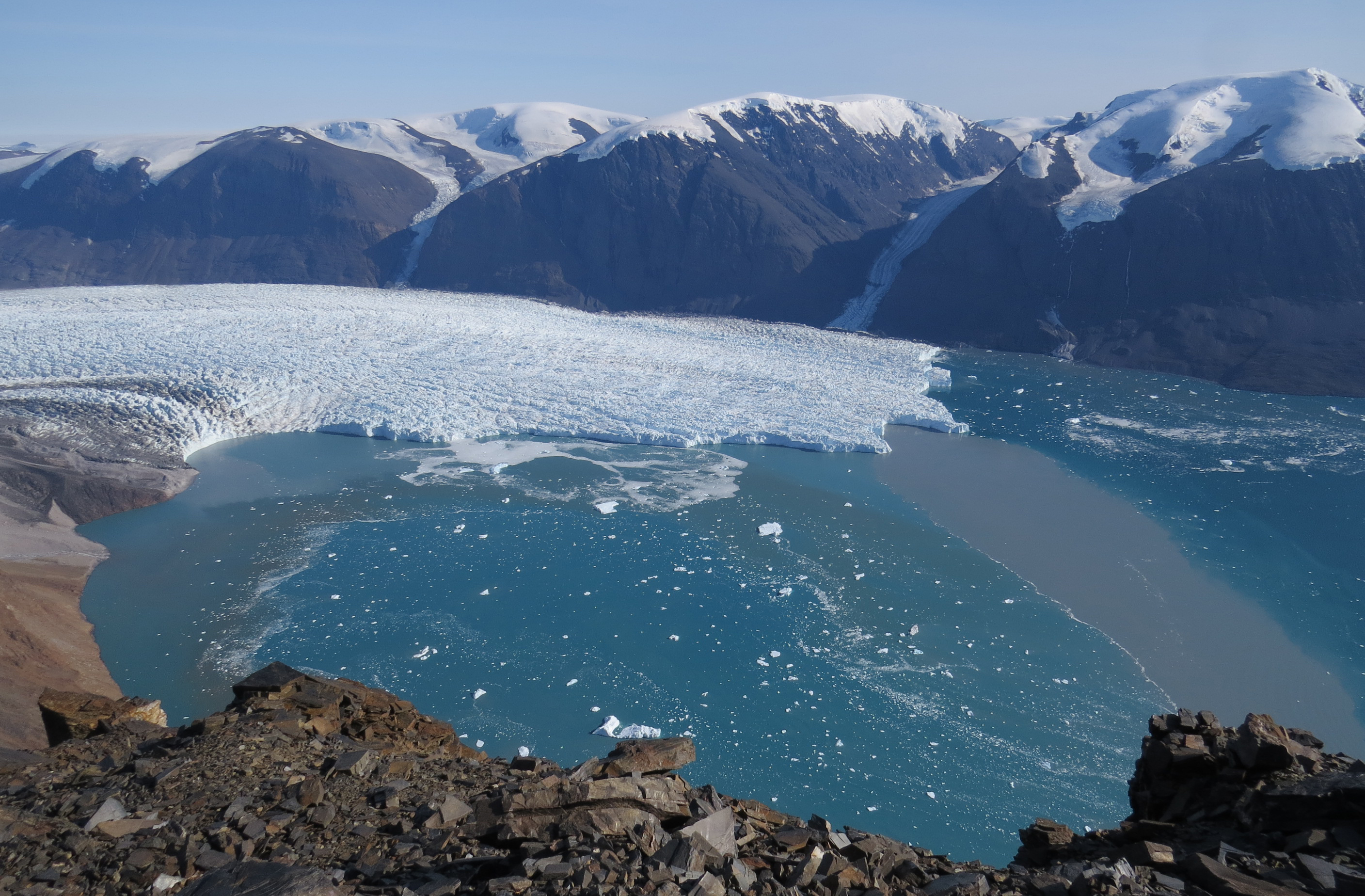
Yahtse Glacier is one of the largest and fastest glaciers in Alaska. Beginning on Mount Miller and terminating in Icy Bay, Yahtse flows 50 feet each day before melting and calving icebergs into the Pacific Ocean.
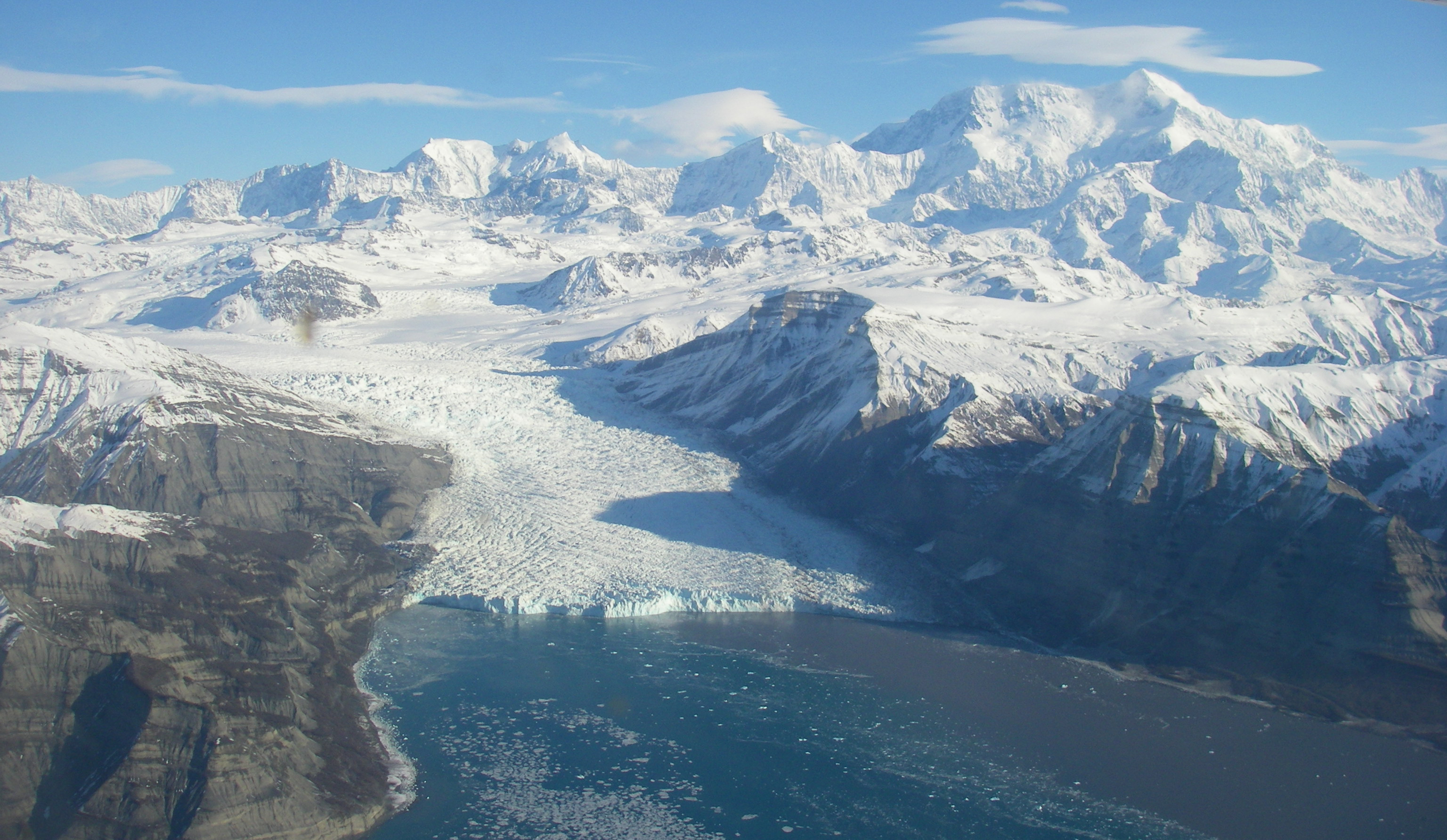
Several factors influence Yahtse Glacier’s outflow into Icy Bay, rainfall and air temperature to name a few, with subglacial discharge and warm ocean water playing a crucial role in how quickly the glacier melts. It’s like dropping an ice cube in water: the ice will eventually melt on its own, but will melt much faster if the water is stirred. Subglacial discharge provides that stirring motion.
“For all these reasons we need to know more about subglacial discharge, there wasn’t a way to measure it in tidewater glaciers,” says Timothy Bartholomaus, research associate at the University of Texas at Austin Institute for Geophysics (UTIG). His research paper, Subglacial Discharge at Tidewater Glaciers Revealed by Seismic Tremor, published in collaboration with five colleagues presents a means to that end.
“This finding was a surprise. I was working on something else and this happened,” he says.
While researching iceberg calving for his Ph.D. dissertation at the University of Alaska Fairbanks, Bartholomaus noticed some summer calving events appeared to be missing from his seismically-derived dataset. The shape of the seismic noise obscuring his detection of calving icequakes looked a lot like hydrographs of subglacial discharge — the amount of water flowing from glaciers ending on land. Comparing his data to to Mendenhall Glacier, which terminates on land, he found the seismic noise correlated to the amount of water coming out of the terminus.
“A hundred years ago seismologists knew not to put seismometers by rivers because they’re noisy and make it hard to study earthquakes. But now scientists are turning that logic on its head and saying maybe we can learn more about rivers through seismometers,” says Bartholomaus. “We can do the same thing with glaciers. And now, for the first time, track subglacial discharge by looking at tremor.”
For the Layperson
The rate at which tidewater glaciers transition ice from sitting on land to melting in the ocean could mean the difference between Miami being a vacation destination or an urban swamp.
“We’ve known for decades the glaciers are melting and sea level is rising. But there is still uncertainty regarding what controls how fast it’s happening,” says Bartholomaus. “Is sea level rise going to remain constant or will the rate double? We’re trying to bat down that uncertainty.”
Bartholomaus points out that the work of glaciologists, in general, is to provide some physical predictions on what might happen in the future. Being able to measure subglacial discharge won’t halt sea level rise, those sorts of changes lie in the realms of policy making and engineering. But this discovery enables new understanding about how tidewater glaciers melt and lose ice into the ocean. These studies will allow future sea level rise models to make even more accurate predictions.
“Researchers kept lamenting ‘if only we could figure out how to measure subglacial discharge,’” says Bartholomaus. “It’s this huge connection between the ice realm and the ocean realm. It’s what links the two. And now we have a tool to study it more closely.”
The Study
Subglacial Discharge at Tidewater Glaciers Revealed by Seismic Tremor